
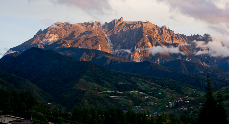
Photo of Mount Kinabalu by Ronykr from Wikipedia
Mount Kinabalu of Sabah, Malaysia is the country’s first World Heritage Site and the highest mountain in South east Asia. Many have climbed this majestic mountain and experienced the breathtaking view from the Low’s Peak Summit, the tallest point of the mountain. The biodiversity that exists in the mountain is magnificent and rare and truly a sight to behold.
The Mount Kinabalu hiking trail has proved to be a challenge worth taking as the pay-off of traversing the rocky terrain and steep slopes is to encounter the splendour of the panoramic surroundings and the beautiful sunrise of Sabah. The friendly mountain guide journeys along with you and helps to enrich your hiking experience while keeping you safe. Embarking on a mountain climb journey requires physical and mental preparation that promises unparalleled and unforgettable experiences that you cannot find elsewhere.
About Mount Kinabalu trails
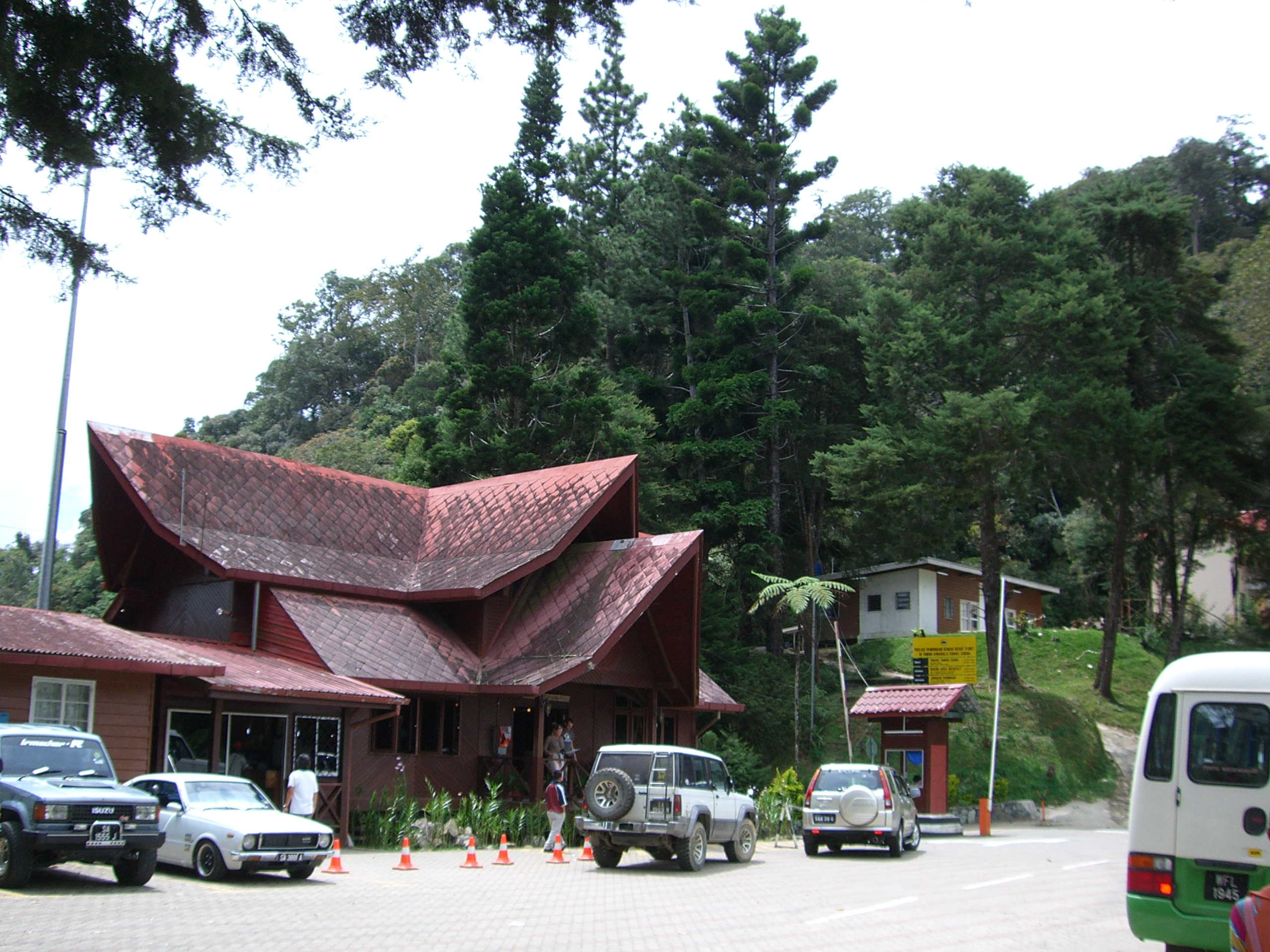
Photo of Kinabalu Park HQ from Wikipedia
The Mount Kinabalu Trail which is currently available is the Summit Trail (Timpohon Trail). It is the most commonly used trail to ascend and descend the mountain. The trail starts at Summit Gate or Timpohon Gate. Another trail which has been closed for a few years by the Kinabalu Park authorities is the Mesilau Trail. It is known to be the more scenic route of the two and starts at the Mesilau Nature Resort.
There are also other shorter trails available in Kinabalu Park but they are mostly reserved for exploring the surrounding forests instead of climbing up to the mountain summit.
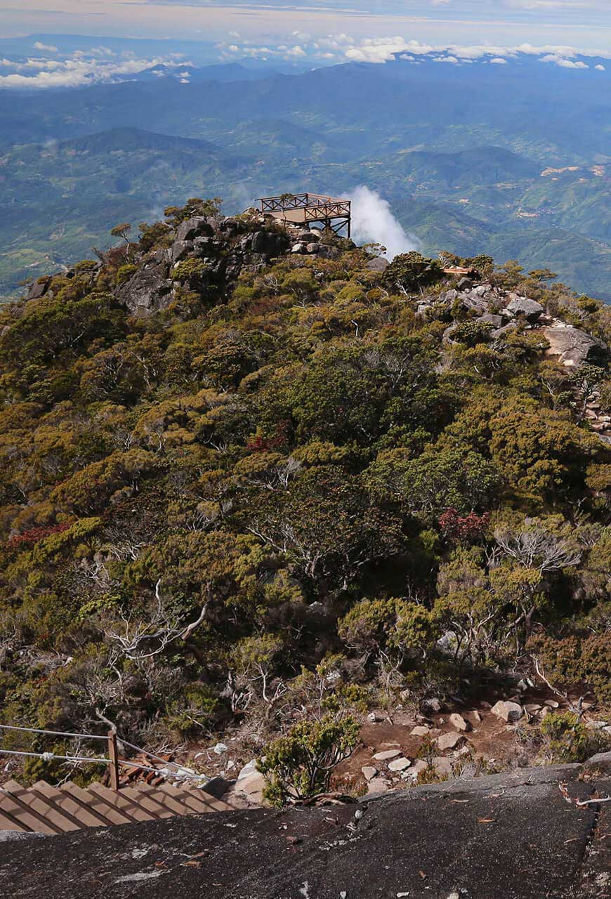
Photo from Sabah Parks website
Climbing Mt Kinabalu via the Summit Trail (Timpohon Trail)
Typically, it takes 2 days and 1 night to traverse Mount Kinabalu. On the first day, climbers will start from the Summit Gate or Timpohon Gate and hike to Panalaban Base Camp where they will rest for the night. A few resting shelters are available for the climbers to take a break.
Day 1
You will start at the starting point which is Summit Gate or Timpohon Gate where you can register and get ready for your climb. This is the best time to check that you have everything you need for your hike because you may experience altitude sickness due to the high altitude of Mt Kinabalu.
From Summit Gate (Timpohon Gate) you will descend to Carson’s Fall, which is named after the first park warden of Kinabalu Park. From there you will climb for about 4 to 5 hours and reach your first shelter, Kandis Shelter The trail winds up a steep staircase along gnarled tree roots and leads you to the mossy world of drifting clouds and pitcher plants.
Keep climbing until you reach your second shelter, Ubah Shelter where some of the most unusual pitcher plants grow in Borneo. They are oddly shaped plants that look like a pitcher. Continue along the mossy forest and past the Sabah Telecoms Stations after walking 2km.
Next, you will reach the third shelter, Lowii Shelter, where the trail continues along the mossy forest abundant with tree ferns and bamboo. At the fourth shelter, Mempening Shelter, you can see many wild begonias growing nearby as well as tree shrews and squirrels.
Proceed the climb and you will chance upon an open exposed ridge at Layang-Layang Shelter, the fifth shelter in the Timpohon Trail. The vegetation and biodiversity start to look different from here on.
Continue to the sixth shelter, Villosa Shelter, at the top of an open rocky patch. A small track leads off to a steep staircase where you can have a fantastic view of Mt Kinabalu. Keep climbing until you reach the seventh shelter, the Paka Shelter, which is named after a large nearby overhanging rock, Paka Cave.
Soon after, you will reach the Panalaban Base Camp where accommodations are available for climbers. Mountain huts such as the Pendant Hut and Lemaing Hut are available for rent, as well as the Laban Rata Resthouse. The accommodations are comfortable for a good night’s rest before continuing the summit climb on the next day.
Day 2
On the second day, climbers will continue hiking early in the morning to reach Low’s Peak Summit. Climbers will start as early as 2:00 am from their accommodation so torch lights are useful to guide their steps as climbers trudge higher on the Mount Kinabalu Summit Trail. Climbers can choose to take the Ranau Trail or the Kota Belud Trail from here. The assigned mountain guide is helpful when climbers are confused as to which trail to follow.
Both trails will end at Sayat-Sayat checkpoint where you can rest at Sayat-Sayat Hut which is the final and highest shelter on Mount Kinabalu. From there, you can continue your hike across bare granite slabs and meet various peaks on the way to Low’s Peak such as South Peak, Ugly Sisters Peak, King Edward’s Peak and more.
Finally, after 8.5km, you reach your final destination where you can watch the beautiful surroundings of the mountain and the sunset if the weather is clear. Low’s Peak marks the end of the Summit Trail of Mount Kinabalu Trail.
Photo by Jeffelvin89 from Wikipedia
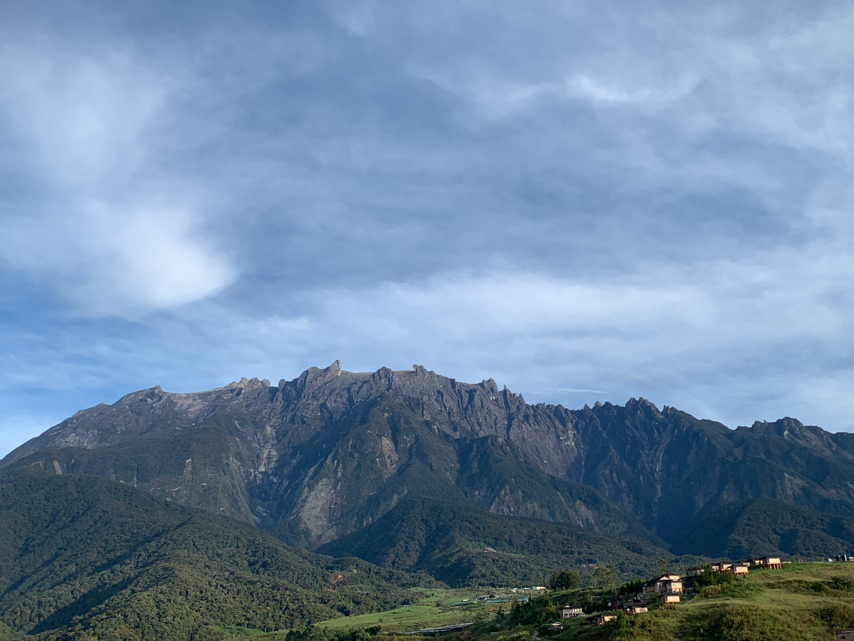
Photo by Evaaudreyanne from Wikipedia
Differences between the Kota Belud Trail and the Ranau Trail
Climbers can opt to take either the Kota Belud Trail or the Ranau Trail to continue their adventure to the Mount Kinabalu summit. Make sure to let your mountain guides know which route you would like to take and follow their guidance to ensure a smooth and hassle-free climb. Both trails will merge at the Sayat-Sayat Checkpoint so they will not make that much difference to your experience. However, the Kota Belud Trail has been proven to be the more challenging of the two options.
Ranau Trail
The Ranau Trail is 1270 meters long which is slightly longer than the Kota Belud Trail. The total distance of this trail to Low’s Peak summit is approximately 2.8km. It is also the standard summit trail to the highest peak of Mount Kinabalu. However, if the mountain encounters bad weather, the Summit Trail will be closed for safety purposes.
Ranau Trail exists after the old route from Panalaban Base Camp to Sayat-Sayat Hut was damaged after an earthquake. Some of the sections in the Ranau Trail do not have wooden steps which makes it difficult to walk up without hauling yourself with a rope. The Ranau Trail is considered the more popular trail because it has a better view of the lush greenery and unique biodiversity out of the two.
In the Ranai Trail, you will encounter many flights of wooden stairs and require an average fitness level. With sufficient training, you can overcome this challenge. However, if the hike proves to be challenging for you, take a short break to compose yourself and enjoy the lushness of the Mount Kinabalu forests.
Kota Belud Trail
The Kota Belud Trail is 1100 meters long which is slightly shorter than the Ranau Trail. However, the Kota Belud Trail have challenging slopes over 60 degrees which makes it slightly more difficult to traverse. However, the wooden steps and ropes along the trail are helpful for a more manageable summit.
The Kota Belud Trail was first introduced in 2016 and has a lesser greenery view than Ranau Trail but it has a spectacular panoramic view of the mountain’s surroundings from the rocky peaks. Only 30 climbers are allowed to go through this rail so make sure to make an advanced booking if you wish to trek along Kota Belud Trail.
One mountain guide is assigned to every 3 climbers due to its more challenging feature and you need to have an above-average fitness level to endure the climb. However, the mountain guides will assess and have the authority to change your route if you do not have the physical endurance for this trail.
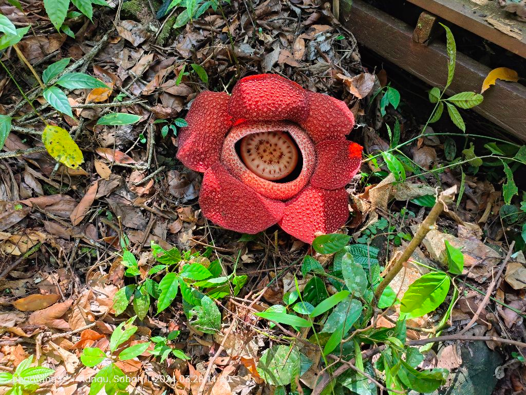
Photo of Rafflesia from Sabah Parks Facebook
Mountain Guide Fees for Mount Kinabalu
You will be assigned a mountain guide when you register for a Mount Kinabalu climb. Mountain guides are required to lead you through the Summit Trail and ensure your safety. Summiting Mount Kinabalu is not an easy feat because some of the slopes might be steep and the misty weather on the mountain may affect your vision.
You will be charged RM350 for a mountain guide for every 5 climbers. However, if the climber is disabled, one mountain guide will cost RM200 per climber due to the delicate nature of the job.
Photo by MissZu2020 from Wikipedia
Gallery
Flora and fauna along Mount Kinabalu trails
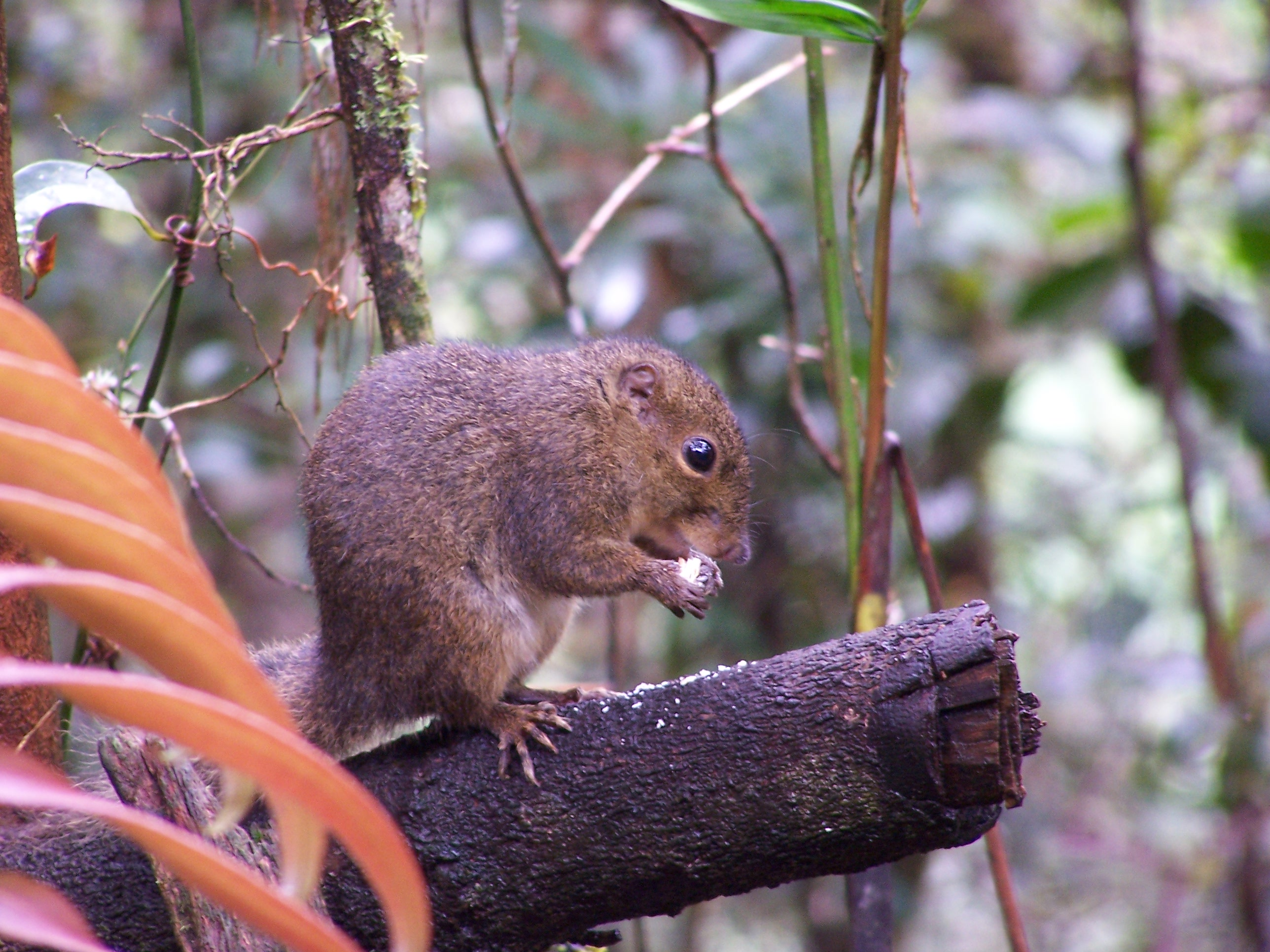
Photo of a mountain squirrel by LotteMae from Wikipedia
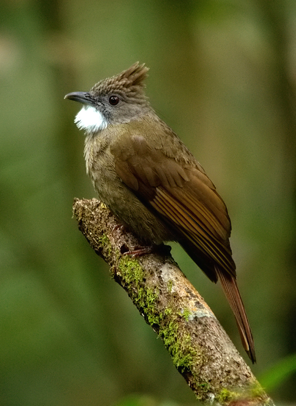
Photo of Ochraceous Bulbul by Seshadri. K.S from Wikipedia
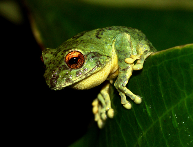
Photo of Male Philautus Bunitus by Seshadri. K.S from Wikipedia
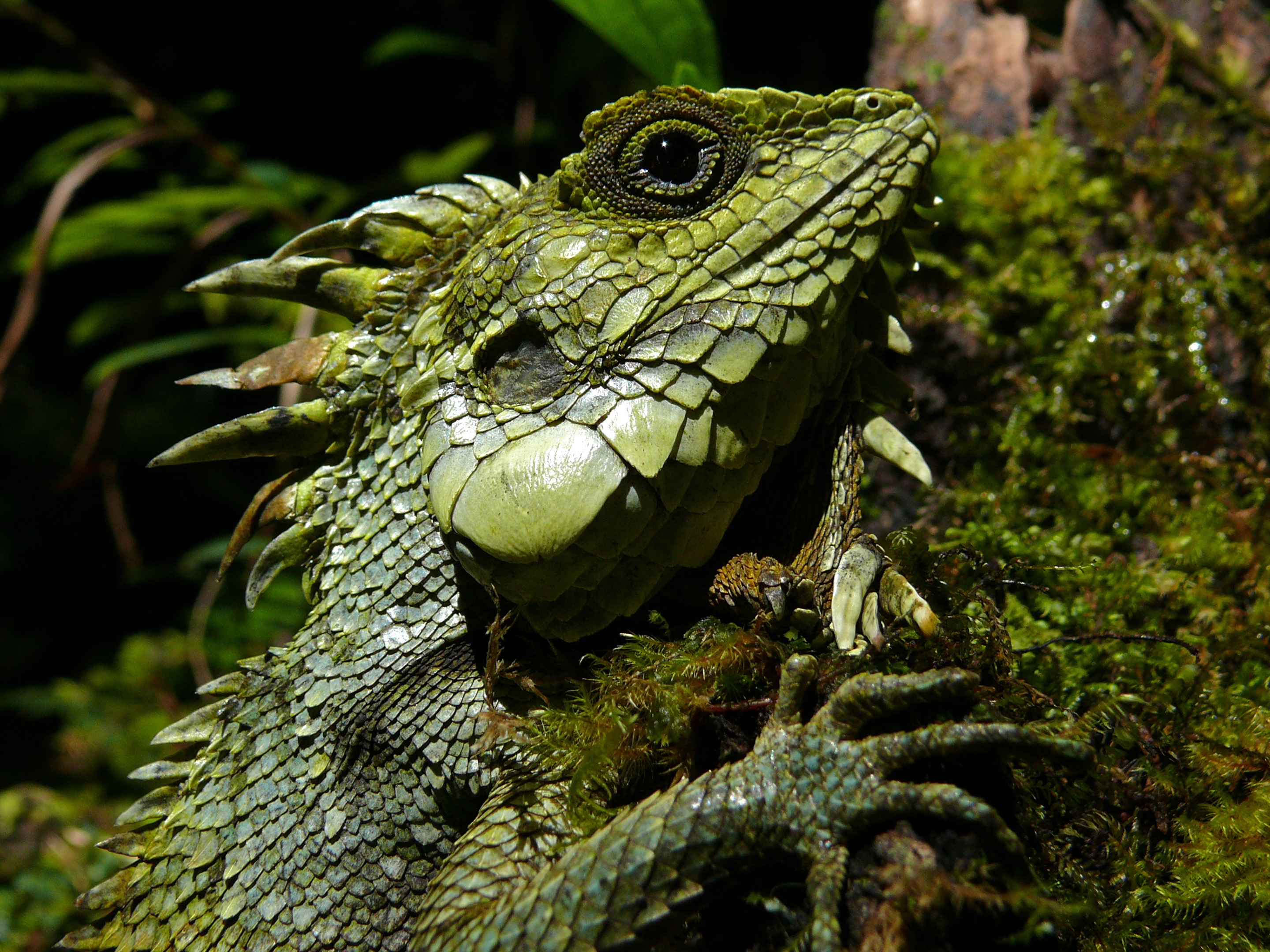
Photo of Crested Dragon by Bernard Dupont from Wikipedia
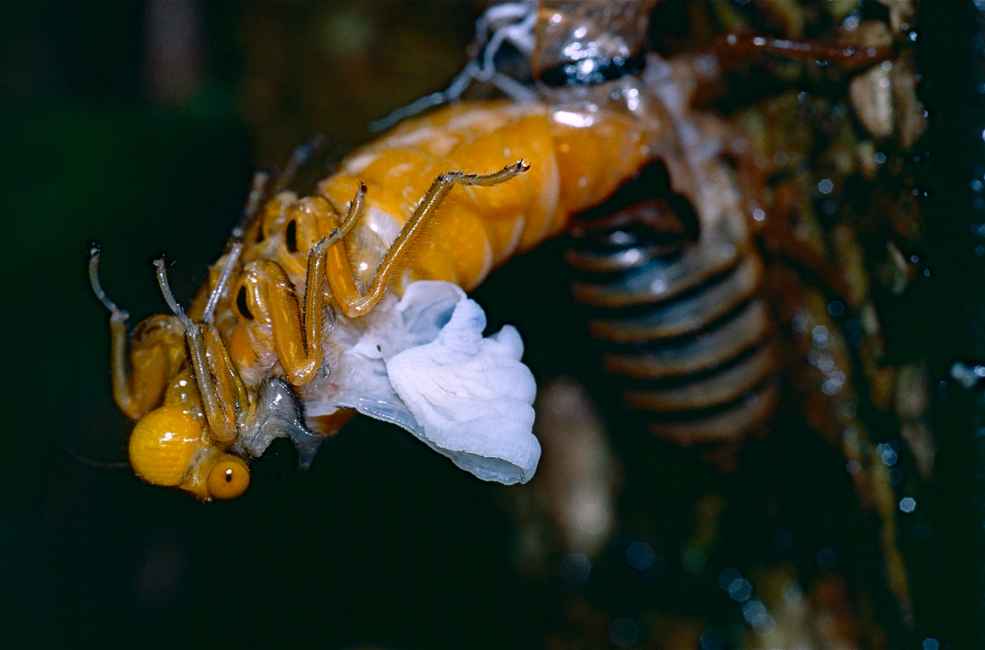
Photo of Black and Golden Cicada by Bernard Dupont from Wikipedia
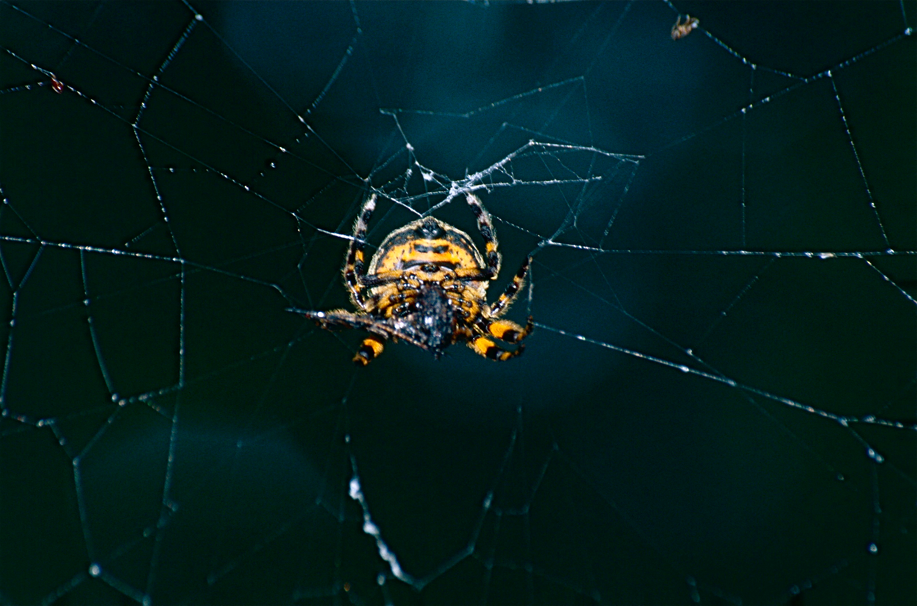
Photo of Orbweb Spider by Bernard Dupont from Wikipedia
Conclusion
From traversing rocky and steep terrains to climbing a multitude of wooden steps with the help of a torch light and a rope, it requires a person of average fitness level to endure. Climbing Mt Kinabalu is not only a physical and mental challenge but also a journey of self-discovery that helps you get in tune with nature and appreciate the God-given gift of lush forests and diverse flora and fauna. It is a privilege to climb the highest mountain in Southeast Asia which is located over 13, 000 feet above sea level that also happens to be a UNESCO World Heritage Site and the pride and joy of Malaysia.
Frequently Asked Questions
How long does it take to hike Mt Kinabalu?
It is advisable to climb for 2 days and 1 night to ensure sufficient rest and a comfortable experience. However, you can also opt for the 3-day 2 2-night package for a more relaxing climb.
Can I climb Mt Kinabalu without training?
It is important to do some training and preparation before climbing Mt Kinabalu as some of the features of the Mt Kinabalu trail can be challenging to overcome and require a lot of upper body and lower body strength. To avoid injury, climbers must be physically fit to hike Mount Kinabalu.
How many trails are there in Kinabalu Park?
There is one main trail named Summit Trail or Timpohon Trail which has 2 mini trails halfway through namely Ranau Trail and Kota Belud Trail.
What other peaks will I encounter on the way to Low’s Peak?
The peaks you will encounter are Victoria Peak, Alexandra Peak Oyayubi Peak, St John Peak, South Peak, Tunku Abdul Rahman Peak, Donkey’s Ears Peak, Ugly Sisters Peak, and King Edward’s Peak.
Do I need a mountain guide to climb Mount Kinabalu?
Yes, you need a mountain guide to climb Mount Kinabalu to guide you to Low’s Peak Summit and ensure your safety.